A new projection for the Fraser River shows it cresting at between six and 6.5 metres, considerably below the projections from just 24 hours earlier, according to Langley Township staff.
“They’ve lowered their prediction, somewhat,” said Roeland Zwaag, the director of public works for the Township.
As recently as Wednesday, provincial authorities were projecting a potential peak of 7.34 metres at the Mission Gauge on July 7. That would break records going back to 1972.
Now the considerably lower levels expected are still high, but down by quite a bit, noted Zwaag.
As of Thursday, June 30, the river level had dipped slightly from a recent peak of 5.8 metres, and was hovering around 5.56 metres.
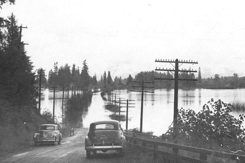
Either projection puts the river considerably below the worst-ever flood in the Fraser Valley, the 1894 disaster, which saw levels of 8.89 metres. That flood, and the similar flood of 1948, temporarily turned Fort Langley into an island and seriously damaged farmsteads up and down the length of the Fraser Valley.
If the river does peak between 6-6.5 metres, there will likely be road closures near the river in North Langley, as well as some farmland being flooded, Zwaag noted. That has happend a few times in the last two decades.
New forecasts will be delivered daily throughout the weekend. Zwaag said a lot depends on how much rain falls over the long weekend, with a potential rainstorm expected Sunday or Monday. That could affect levels again.
READ ALSO: Flood advisory in place for Langley Township as Fraser River water level rises
READ ALSO: Evacuation alert issued for Langley residents near Fraser River
According to the Township of Langley’s flood response plan, door-to-door evacuations of the most-threatened properties could begin if the water level hits 6.3 metres.
The Township has issued flood alerts to homes in danger zones, and is updating information at www.tol.ca/news/Freshet-2022/. Sand and sandbags are available at the Township Operations Centre at 4700 224th Street, 24 hours a day.
Zwaag said there are plenty of supplies still available at the Operations Centre.
People in threatened areas should be prepared to have to leave and have an evacuation plan.
Zwaag also asked people to obey signs closing off roads if any streets do get flooded. The water can be deeper and faster than they expect.
“We just want people to stay safe,” he said.
Have a story tip? Email: matthew.claxton@langleyadvancetimes.com
Like us on Facebook and follow us on Twitter.