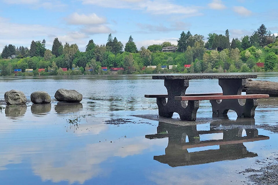
Flooding has forced the closure of Derby Reach Park near Fort Langley.
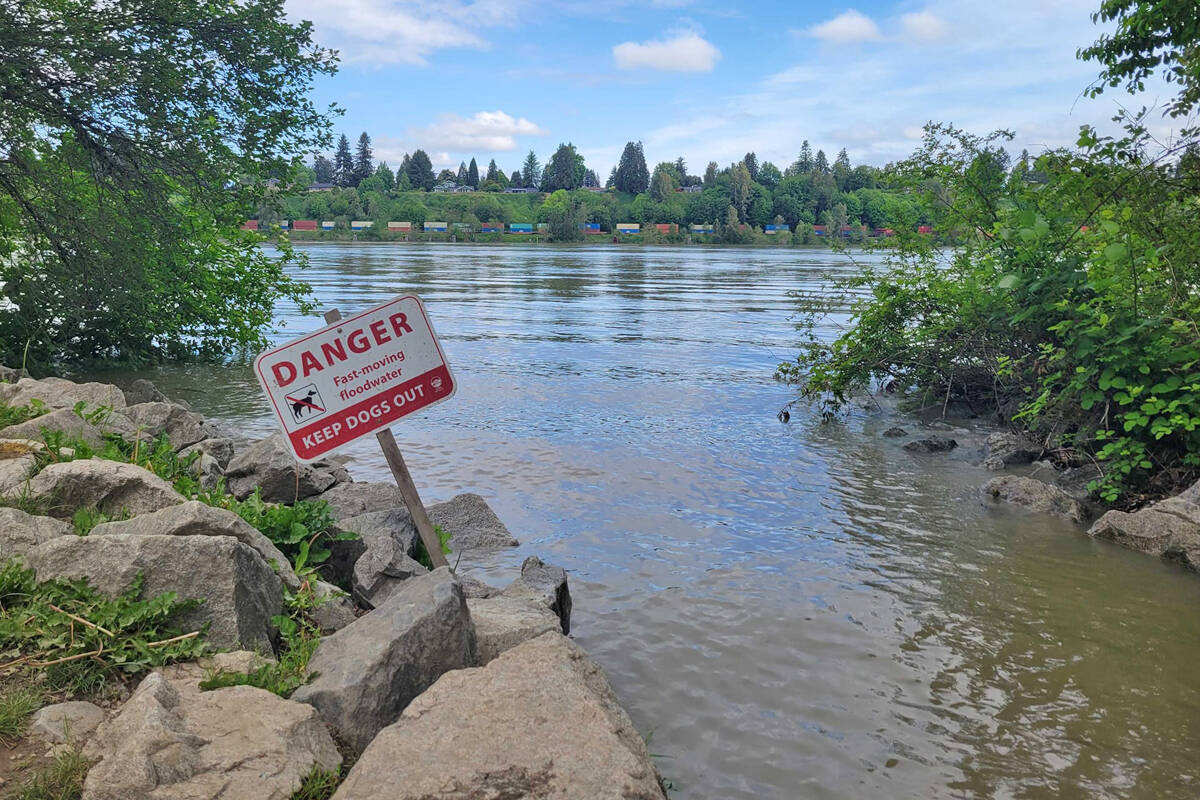
Signs warning about “fast moving floodwater” and “caution fastrising water, use extra care” went up after the rising levels overflowed the river banks.
Metro Vancouver closed the campground until further notice.
An online notice said campers with existing reservations will be contacted and refunded accordingly.
“Metro Vancouver staff monitor flood levels and will determine when the campground should re-open,” the notice said.
Langley Township advised the Mission Gauge on the Fraser River has reached 5.50m, resulting in a flood advisory for properties in the unprotected flood plain areas of Northwest Langley, Glen Valley and Fort Langley.
“This is not an order to evacuate,” the online advisory explained.
“River levels are rising and expected to continue to rise,” the Township notice said.
“Being near fast flowing bodies of water can be dangerous.”
Residents are advised to stay clear and avoid potentially unstable riverbanks, and avoid recreational activities such as fishing, swimming, boating or hiking near high streamflow rivers or streams.
Closures announced included the Langley Rowing and Paddling Centre Dock, Marina Park Boat Launch, a portion of the Fort to Fort Trail at Marina Park, and the section of the trail from Allard Crescent to the Salmon River Dyke Station, and the Trans Canada Trail on the west side of 208 Street, south of Allard Crescent.
READ ALSO: Some evacuation orders rescinded as flood threat recedes in Cache Creek
The B.C. River Forecast Centre has issued flood watches for rivers and tributaries around Fort St. John, Taylor, Chetwynd, Moberly Lake, Pine Pass, Hudson’s Hope and Dawson Creek.
It said unseasonably hot weather over the past few weeks has led to heavy snowfall melts.
READ ALSO: Temperature records fall in Langley
Have a story tip? Email: dan.ferguson@langleyadvancetimes.com
Like us on Facebook and follow us on Twitter.