Horses, wagons and extremely challenging road conditions have long since given way to motorized vehicles and paved roadways, but reminders of Langley’s early transportation history have been reinstated along the south side of Fraser Highway.
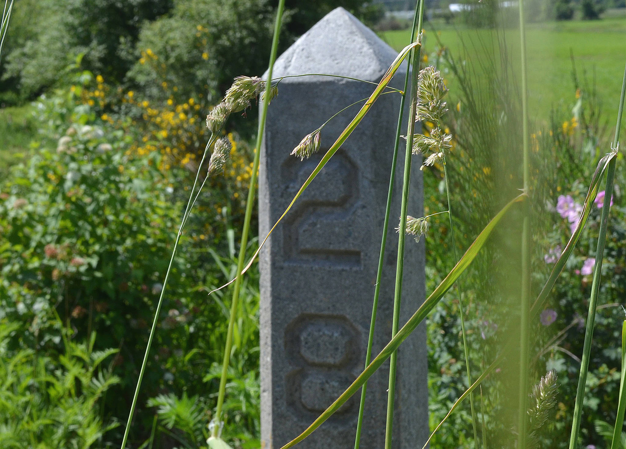
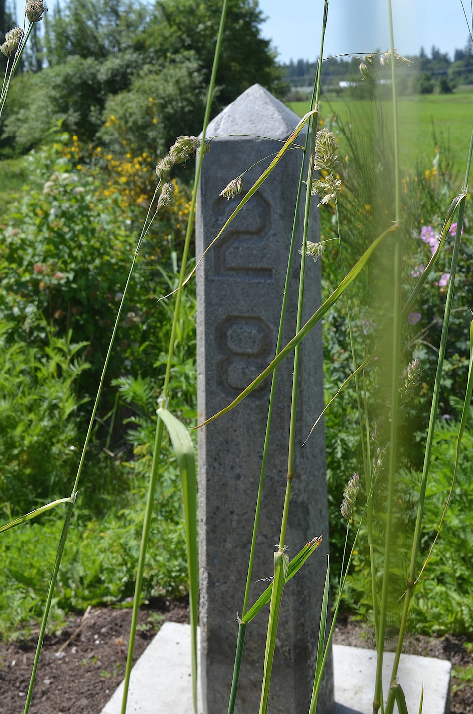
Concrete mile markers that were used close to a century ago have been found, repaired, and put back in place by the Township of Langley between Murrayville and Aldergrove, thanks to some detective work and help from the community.
The concrete markers had originally been installed along Fraser Highway in the early 1930s to mark the travel miles from Vancouver — starting at the historical location of the Main Post Office in Vancouver at Hastings and Granville Streets — to points east throughout the Fraser Valley.
“It’s a little bit of a mystery because we don’t know who installed them, whether it was the provincial government or an early motoring association,” said Township of Langley Heritage Planner Elaine Horricks.
But it was known that nine mile markers had been installed through Langley Township, and one of them, Mile Marker 35, located in the linear park in the 26400 block of Fraser Highway, had been documented for the Township’s Heritage Inventory in 1993.
Earlier this year, the Township and members of its volunteer Heritage Advisory Committee (HAC) decided to investigate and undertook a search to see what they could uncover.
“It was a bit of a treasure hunt,” Horricks said. But with help from historic surveyor Jim Foulkes, and knowing that the markers would have been placed at one-mile intervals, the HAC’s search began for the lost markers, several of which were found in nearby ditches and fields. Over the years, and due to the agricultural nature of the area, some had slid into the mud and were partially covered over, but survived undamaged.
Almost all of the original markers were found and repaired, but two of them were deemed lost. Replicas of the missing two were created, and this spring, all nine were reinstated along Fraser Highway, as close as possible to their original locations. Plaques have been placed on the markers to identify them, and interpretive panels explaining their history are being installed at Mile Marker 29 in Murrayville and Mile Marker 35 in Aldergrove.
“These are some of the only markers of this type remaining today,” said Horricks, noting they are an important link to the area’s transportation history, and illustrate the change in infrastructure that came with the invention of motor vehicles.
The Township of Langley’s transportation history got its start in 1858, when the Gold Rush brought many Europeans to British Columbia. At that time, horses and wagons were used to move people and goods, and the influx created a need for new routes from the population centres on the west coast to the gold fields upcountry. A number of trunk roads were constructed through the Fraser Valley, including the New Westminster to Yale Waggon Road, known as Yale Road, which was built through Langley between 1872 and 1874.
By 1930, cars had become the popular mode of transportation, and Old Yale Road, as it became known, was chosen as the local route for the new Trans-Canada Highway. At that point, construction began on Fraser Highway, a new roadway that was specifically built for cars. Fraser Highway reflected the change in abilities from horse-drawn wagons to gasoline-powered automobiles and was much easier to negotiate than the previous road. It had fewer curves and dips and gentler slopes, having been re-routed in areas to improve grades.
By 1931, Fraser Highway was well on its way to being completely paved, and concrete mile markers labelled 28 through 36 were installed along the south side of Fraser Highway through the Township of Langley. By 1964, the new Trans-Canada highway was constructed through the Fraser Valley, north of Fraser Highway, leading to the rapid urbanization of the area.
The restored Fraser Highway mile markers are located on the south side of the road and can be found:
- 28 Across the highway from Derek Doubleday Arboretum, adjacent to 21151 Old Yale Road
- 29 Adjacent to the landscaped pathway at 22057 Fraser Highway
- 30 On the boulevard between the sidewalk and road in the 22800 block of Fraser Highway
- 31 On the road shoulder at 23449 Fraser Highway
- 32 On the road shoulder at 24192 Fraser Highway
- 33 On the road shoulder at 24897 Fraser Highway
- 34 West of the bus stop in the 25600 block of Fraser Highway
- 35 Next to the pathway in the Fraser Greenway linear park in Aldergrove in the 26400 block of Fraser Highway
- 36 In downtown Aldergrove in front of 27256 Fraser Highway