Lower Mainland commuters have a new tool to help gauge how long they'll have to sit in traffic on key routes and whether there's a faster alternative.
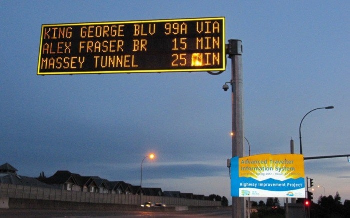
The province has installed five new overhead signs that display estimated travel times between the Oak Street Bridge and King George Boulevard via either the Massey Tunnel or the Alex Fraser Bridge.
The new message signs, part of a $2.7-million expansion of B.C.'s Advanced Traveller Information System, supplement others that tell drivers how long the waits are at local border crossings.
The signs are located at:
- Highway 10 westbound, west of Scott Road in Delta.
- Highway 17 northbound, south of Ladner Trunk Road in Delta.
- Highway 91 southbound, south of Howe Street Overpass in New Westminster.
- Highway 99 southbound, south of Oak Street Bridge near Cambie Street in Richmond.
- Highway 99 northbound, south of Highway 91 in Surrey.
Traffic flow is measured between various points along the Highway 99 and 91 corridors through intelligent road sign technologies and congestion tracking.
Transportation ministry officials say the signs can also be used to display other important travel information, such as road conditions, weather, route options and public safety messages, such as Amber Alerts.