River forecasts show that the recent hot weather may result in the Fraser River peaking near Langley by Sunday, May 21, and local officials are being cautious but are not yet too worried.
Record high temperatures have melted snow on Interior mountains quickly, and the river levels are expected to rise over the next few days.
As of Monday, May 15, water levels were hovering just above four metres at the Mission gauge, but levels are expected to increase and peak at just under six metres by May 21, said Aaron Ruhl, the Township’s manager of engineering and construction services.
“The six-metre mark is when we start to see water come up on the roadways, on Allard [Crescent] and in Glen Valley,” Ruhl said.
There have been several times over the past few years when roads such as the northern end of 208th Steet, parts of Allard Crescent, and a few sections of River Road east of Fort Langley have had to shut down for a few days as they were covered by water. The areas affected are typically those outside of the dikes.
So far the river forecasts aren’t concerning beyond the possibility of a few similar incidents.
For those who live in low-lying areas beyond the dikes, sand and sandbags are available for free at the Township of Langley Operations Centre yard at 4700 224th Street.
Residents with properties at flood risk got letters from the Township back in February this year, reminding them to have an emergency plan and kits, said Ruhl.
The Township also has plans to communicate with the Kwantlen and Katzie First Nations, both of which have reserve lands that is on the riverfront and is prone to flooding.
When water levels reach 4.9 metres, Ruhl noted that the Township starts weekly in-person inspections of the dikes to ensure they are stable. At 5.5 metres, those inspections become daily events.
Flood advisories were in place for parts of Langley just last year, after a very wet, cold spring abruptly transitioned to a hot, dry summer.
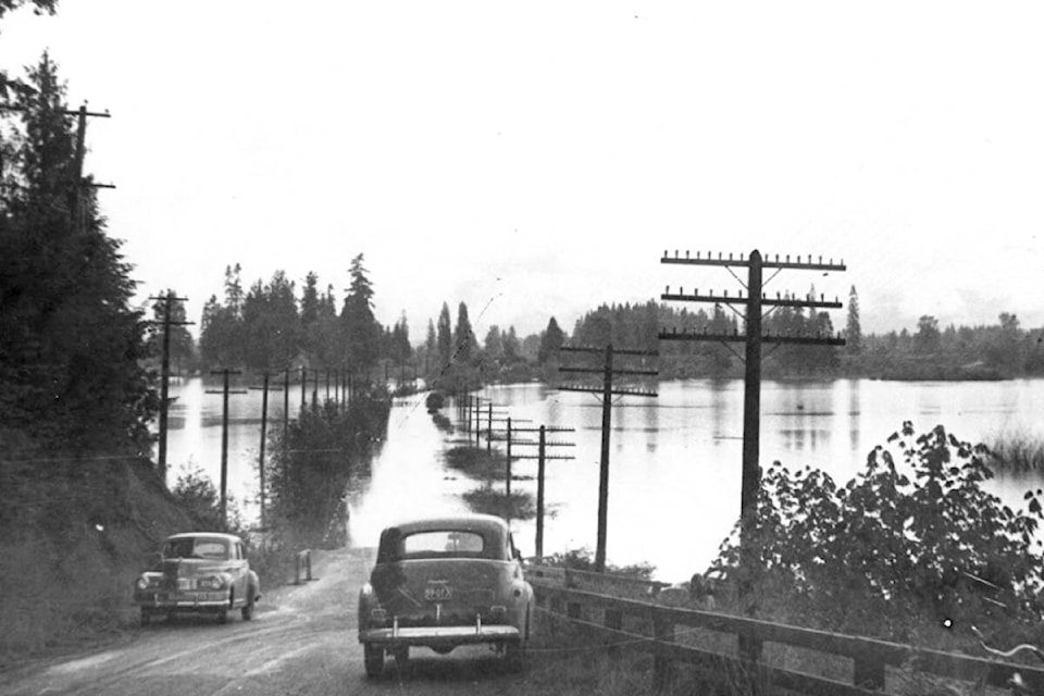
The worst flood in the last 100 years took place in 1948, when water rose so high that Fort Langley briefly became an island.
PREVIOUSLY: Flood advisory in place for Langley Township as Fraser River water level rises
READ ALSO: Flooding prompts state of local emergency in Cache Creek
Have a story tip? Email: matthew.claxton@langleyadvancetimes.com
Like us on Facebook and follow us on Twitter.